Galileo at a glance
Galileo is Europe's global navigation satellite system. It provides accurate and reliable positioning and timing information, used for example in your mobile phones, your cars (and in the future autonomous and connected cars), railways, aviation and other sectors. Galileo has been operational since December 2016, when it started offering services to public authorities, businesses and citizens.
Why are positioning, navigation and timing important?
To calculate our position, we rely on Global Navigation Satellite Systems or GNSS. A GNSS refers to a constellation of satellites providing signals from space that transmit positioning and timing data to devices with the appropriate receivers. The receivers then use this data to determine location. Currently in the world exist four GNSS the most known being the US GPS.
In 2016, the European Union launched its own GNSS called Galileo. Since then, the system has been providing improved positioning, navigation and timing information to over four billion users across the globe.
But in addition to helping, us commute to work or avoid getting lost while backpacking, Galileo supports the daily operations of a wide range of industries such as transport, logistics, telecommunications, and energy. Around 10% of the EU economy depends on the availability of global navigation satellite signals.
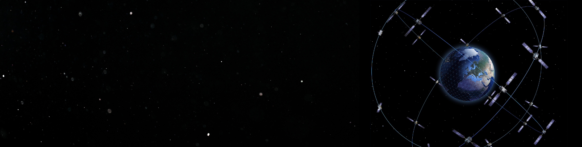
The structure of Galileo
Galileo consists of 28 satellites orbiting Earth at an altitude of 23,000 km. The signals of Galileo are freely transmitted to anyone who has a device capable of receiving its signals (e.g., smartphone). Galileo is four times more accurate than GPS providing 1 meter accuracy and a broad range of services.
Galileo is fully funded and owned by the European Union and unlike other GNSSs it is under civilian control. Most of its services are provided free of charge all around the world.
But Galileo is much more than satellites in space. The ground segment consists of two main control centres, one in Fucino (Italy) and the other in Oberpfaffenhofen (Germany), which control the satellites and manage the navigation system. Additionally, the ground segment includes the European GNSS Service Centre (GSC) located in Torrejón (Spain), the Galileo Security Monitoring Centre (GSMC) with facilities in St. Germain-en-Laye (France) and Madrid (Spain), and the Galileo Reference Centre (GRC) located in Noordwijk (The Netherlands). These facilities play crucial roles in the operation and performance monitoring of the Galileo system, ensuring its accuracy and security.
What services does Galileo offer?
- Galileo Open Service (OS): the most commonly used service we all rely on, in our phones, cars and smartwatches.
- Galileo Search and Rescue (SAR): allows the location of people in distress in less than 10 mins and accuracy error below 5km.
- Galileo High Accuracy Service (HAS): offering an accuracy down to 20cm for applications such as autonomous cars or drones.
- Galileo Public Regulated Service (PRS): for authorised users of EU Member States, such as defence, civil protection services, customs officers, police, etc. This system is particularly robust and fully encrypted to provide service continuity during emergencies or crisis situations.
Use cases
The services provides by Galileo are already used in applications such as automotive navigation and location-based mobile phone services as well as in many professional applications in agriculture, transport, and surveying. Precise time and synchronisation are critical aspects of a wide range of strategic activities around the world. It is a crucial, but often unrecognised, part of today's modern infrastructure, especially in the case of systems that support societal functions such as health, safety, and security. GNSS timing services, essential for the precise synchronisation needed for mobile phone network management, energy sector applications such as smart electricity grids, and banking transactions, are globally accessible. They provide users with access to global time standards, achieving accuracies within a few tens of nanoseconds.
- Agriculture: Galileo helps farmers accurately guide their tractors and spay fertilisers and water only where needed, therefore reducing emissions and saving water.
- Maritime: Thanks to Galileo ships can optimise they routes and reduce CO2 emissions.
- Location Based Services: Mobile application that use geolocation such as maps and rideshare apps can benefit from Galileo’s additional accuracy.
- Timing and Synchronization: Galileo is used to precisely timestamp bank and financial transactions.
What does the future hold for Galileo?
On the horizon is the second generation of Galileo satellites, which is not a new system but an evolution of the first generation. Twelve more powerful satellites are being developed, equipped with fully digital payloads, electric propulsion, advanced navigation antennas, improved atomic clocks and additional robustness and security features. What's more, the satellites will be built in such a way that they can be reprogrammed while in orbit — a feature that will allow to make rapid changes in response to market demand.
New services are also on the way, including the new Emergency Warning Satellite Service (EWSS). This service will provide direct warnings to populations confronted with the consequences of natural or human-made disasters. Using Galileo satellites, it will transmit information related to the hazard, including its severity, time of onset, expected duration and impacted areas, as well as instructions directly through smartphones and navigation devices. Expected to be operational in 2025, EWSS is designed to complement existing warning systems, particularly in remote and rural areas or where networks are congested. It has been successfully tested to provide rapid alerts within 60 seconds.